Wednesday, May 31, 2017

Day 11 - La Malbaie to Rivière du Loup

63.1 km - Total so far 742.8 km  


RWGPS: https://ridewithgps.com/trips/14966802
Relive: https://www.relive.cc/view/g11988099474

The one day of rest really paid off and we were on the road by 7:22 am. We had a nice warm up climb out of La Malbaie and followed that with a more robust climb towards St-Fidèle. We new of the climbs at St-Fidèle having been there on a past Grand Tour in 2013. With the wind to our back, finally after nine days, we felt this would be a fun and challenging ride to St-Siméon and the ferry.


A last look back at La Malbaie

Having fun getting to the top of the climb, 
nice and steady does it


We took Hélène's bike out of the support vehicle to stage this picture (Ha!Ha!)

It was a short ride to Saint-Siméon and a fun one. Yes we did have to work on those hill climbs but a good tail wind of 15 km/h actually made it very enjoyable. There is a wide shoulder as you can see in the picture above and most vehicles changed lanes to remain far away from us. Once in a while a large truck would come along side us but at relatively low speed as they to had to climb the hill.

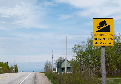
A very confusing sign. We are have been heading EAST for the last
11 days, yet the sign says "WEST". What to do?

Very low clouds moving over the Saint Lawrence towards the Charlevoix shores

Seabirds along side 

Steaming away from Saint-Siméon towards Rivière-du-Loup

Home at Camping du Quai, Rivière-du-Loup
Forecast for tomorrow is mainly cloudy with some rain early in the morning and again late afternoon. Once again we will have the benefit of a tail wind,


39.21 miles - Total so far 461.55 miles

Tuesday, May 30, 2017

Day 10 - Pointe-au-Pic to La Malbaie

7.6 km - Total so far 679.7 km


RWGPS:  https://ridewithgps.com/trips/14941468
Relive: No relive since we did not pedal at least 10 kms

See the 'Where we are map' at the bottom of the page

After nine days of pedalling with most days heading into a northeasterly wind, we decided to take a day off. As soon as we left the campground this morning, we realized what a wise decision we made stopping when we did. From the campground, we dropped from 250 metres in altitude to 9 metres in the space of three kilometres. The descents were very steep with most rated at 10% and two at 15% and winding. That would have been a scream on our road bicycles but on loaded touring bikes with trailers, not so.


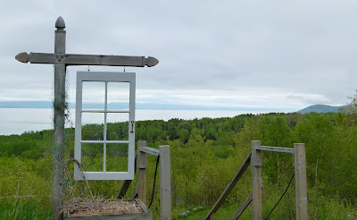
Campground with a "window" on the Saint Lawrence River

The view as we started our decent to La Malbaie
 (where the tree line and near sea shore meet on the left)

In La Malbaie we made a quick stop at the park by the river. We were approached by a couple who asked if we were climbing the hill outside Baie St Paul yesterday, 'Yes, that was us', I quickly replied. They brought up how hard it must have been to climb the hill at Ste-Irénée (starts at km 34 on Day 9 - RWGPS).

Hélène decided it was time to make her first stop at the 'Visitor Information Office' for this trip. You will remember how much she enjoyed terrorizing the people behind the counter on our first trip, It did not happen this time. The office was staffed by two very knowledgeable people who answered each of our questions about the local area and even ones about St-John's, Newfoundland. Turns out the young lady lived in St-John's for one year.

When I enquired about the route to St-Simeon and asked if we would encounter another climb like Ste-Irénée, the gentleman bowed his head and mumbled an answer. He looked up and said no but stated that there is a nice climb at St-Fidèle. 

We found out from the locals that no one likes the hill at Ste-Irénée as it is very steep, very narrow road, a sharp 90-degree turn and vehicles get awful close to each other. I can't for the life of me figure out how they manage that hill in the winter.

Within minutes of checking into the hotel, it started raining very hard, We even saw a guy building a very large boat. It is still raining and we hope it stops soon so we can go for a walk, It will be nice to have a walk that does not involve pushing our bikes uphill.

It did finally stop raining so out the door we went.


Daniel being led by three of the local tourist guides.

Significant buildings outline painted on the wall.
The tree has the name and a description of the buildings.

Looks like a painted waterfall but is actually
 efflorescence from the cement

The park close to the Visitor Information Centre

Hélène relaxing inside the Laure Conan Library, La Malbaie 
(The library itself)


4.72 miles - Total so far 422.35 miles


Monday, May 29, 2017

Day 09 - Baie St-Paul to Pointe au Pic

42.2 km - Total so far 672.10 km 


RWGPS: https://ridewithgps.com/trips/14926273

Today was by far the most difficult 42 km either of us had ever pedalled. I can understand why 'Le Chemin du Fleuve (Hwy 362)' is not very popular with cyclists. There is a very long and steep climb just out of Baie St-Paul and the pattern repeats itself for the next 42 km. Some climbs were so step we had to push the bikes up the hill. This happened quite often.

It was overcast and raining a bit when we left but the sun started to shine by the time we got to the village of Les Eboulements around 12:30, It took us nearly 4:30 hours to do 19 km. We did stop a few times to chat with people but still it was a pretty slow grind.

Baie St-Paul is very picturesque and a well known artist gathering spot.
Many of the Group of Seven spent their summers here.


Hélène adjusting her wardrobe after the warm-up to the first of many long steep climbs

I look a little up tight because I had to push my bike for the last bit of the hill.
Hélène 'The Machine' pedalled all the way up

We enjoyed a nice chat with 'Martin' as we were recovering
 from  this long climb. 


What goes down the hill has to come up the other side. 


The Village of Les Eboulements. Our route took us past
the church and over the hill.

Resting the forearms and steadying the nerves for
the next bit of downhill

One of the bikes having a well deserved rest

Today was a tough day. We did not make it to La Malbaie because we were exhausted and where fortunate enough to stumble on a campground. The sign said closed but the owner must have felt obliged to help out the two tired cyclists. We are glad he did.

We had to cancel the line dancing we had planned for this evening.


26.22 miles - Total so far 417.62 miles

Sunday, May 28, 2017

Day 08 - Sainte-Anne-de-Beaupré to Baie St-Paul

67.9 km - Total so far 629.90 km 


RWGPS:https://ridewithgps.com/trips/14902557
Relive: https://www.relive.cc/view/g11927971911

Today we were challenged by the terrain and the weather that turned nasty after lunch. We made it to Baie St-Paul, our intended stop.

We did a little bicycle maintenance before leaving the campground at 8 a.m. We followed Avenue Royale to the intersection of Hwy 138. We took one look at the climb facing us on Hwy 138 and decided to take the route recommend to us the day before. Once again on the bike path, we had to be rescued and led back to the correct trail. We wish to thank the good Samaritan that got involved and saved us from much unnecessary physical effort. You can see where we turned around on Relive and RDWGPS!


One mean looking hill, best to go with Plan B

Plan B we head up the hill behind me

On the right bike path following our rescue

Hwy 362 is very popular with local cyclists. We had a good chat
with the one's in the picture

Hélène and I just finished having a chat about what items are truly essential and what could be left at home to lighten the load. What do we see but a touring cyclist riding by with trailer and dog. Looks like "essential" means different things to different people. 


We had to leave Hwy 362 and rejoin the less quiet Hwy 138. Just after we crossed the road, an SUV abruptly stopped ahead of us and a gentleman got out in a hurry. I did not immediately recognize him but Hélène did. It was our dear friend and Encadreur(e) team leader, Jean-Paul and his lovely lady, Francine. What an incredible coincidence. That one encounter made up for the unpleasantness, we were to experience for the remainder of the afternoon.


At 741 meters, we thought it would be all downhill from here...wrong!
At about 12 km from Baie St-Paul we saw signs directing truck drivers to check their brakes, where to brake on the 8 km long downhill and where the two runaway safety lanes were located. These two cyclists also paid close attention. With loaded bikes on a steep downhill, we have to decide on a strategy to tackle the descent. We have to stop often to relieve the strain on the forearms and also let the bicycle rims cool (less an issue today as it was cold and wet). The greater the pucker factor on the descent the more focused you are on what is directly ahead of you and the less you see of the scenery. Maybe on our next trip here in our VW bus, we will enjoy more scenery.

I suspect that cycling through Charlevoix is less popular than doing so across the St-Lawrence river on Hwy 132. Although the bad weather made it an even tougher day, the challenge and the gained experience makes us more capable touring cyclists. We get to repeat the whole thing again tomorrow on Hwy 362. 

42.19 miles - Total so far 391.40 miles

Saturday, May 27, 2017

Day 07 - Sainte-Foy to Sainte-Anne-de-Beaupré

46.6 km - Total so far 562 km 

RDWGPS: https://ridewithgps.com/trips/14874624

Today was a day with the most stops eveerrrrrrrrrrrrrr!!!!!!!

We headed out from Laval University before 8 a.m. and straight for la Cote Gignac and le Parcours du Littoral that runs along the St-Lawrence River Sainte-Anne-de-Beaupré. It did not take long before we had the camera and out snapping pictures.

Québec City bridges and an ocean going container ship

The first of many stops chatting with fellow cyclists.
Note cyclists and pedestrians on separate paths.
 

We chase away horses with our bear bells

rue Champlain, a narrow street with older well taken care of row houses.

We were surprised to see how busy with cyclists the path was that early in the morning. We got lots of waves, smiles and many a thumbs up. When we stopped to photograph the horses above, we noticed a street running parallel to the bike path and hugging the cliff, la rue Champlain. I bet most people who live in Quebec City are not familiar with it. Glad we are now.

Plaque of the Undaunted Fifty
Near the industrial zone of Anse au Foulon, we stumbled on two plaques (French and English) that state “Here stood the Undaunted Fifty safeguarding Canada, defeating Montgomery at the Pres de Ville Barricade on the last day of 1775, Guy Carleton commanding at Quebec.”. Had we not been on bikes, we would have never seen them.

The mandatory picture of the Chateau Frontenac Hotel. Construction
 equipment highlights how well the old buildings are cared for.

Hélène enjoying a quiet coffee in La Basse Ville (Old Québec)
We stopped for coffee across the street from the bike path and watched a great number of cyclists go by. We saw a heavily loaded tandem bicycle towing a trailer. We had a later encounter with a local cyclist who told us the folks on the tandem were Australians heading to Vancouver. They had been at his home for a few days, resting. This kind cyclist was concerned that we might have missed a turn on the bike path which would have caused us to head back towards Montréal. He was correct.

Originally we planned to leave Québec City and follow the Avenue Royale from its start. Since I had never been to les chutes Montmorency, we opted for the bike path up to the falls and then back on Avenue Royale. Very similar to Le Chemin du Roy, L'Avenue Royale is lined with very old ancestral homes of various architectural styles. The road is also very popular with cyclists. 

As a matter of fact, today, there was a small traffic jam in the village of Chateau-Richer. An ever growing number of curious cyclists stopped at an intersection to chat with two touring cyclists towing trailers. Local drivers appear to be well acquinted with the large number of cyclists and not one car horn was heard. 

Caveau a légume(root cellar) on the Avenue Royal (circa 1660)

A great number of the homes have signs such as this one that indicates when the house was built,
the architectural style and the name  of the original owner. Very informative

A well cared for home but the owner replaced the original
windows with ones of aluminium 

A cool looking older building in Sainte-Anne-de-Beaupré

An unusual sideview of the Sainte-Anne-de-Beaupre Shrine

A most challenging climb, 24%.
Right after the picture, he headed up back up the hill.

All in all, a very good day. We got to see lots, had many encounters with fellow cyclists. 

Find below a short summary of Week 1. Week 2 starts tomorrow!


28.96 miles - Total so far 349.21 miles

Friday, May 26, 2017

Day 06 - Grondines-Deschampbeault to Sainte-Foy

71.1 km - Total so far 515.4 km


RDWGPS:https://ridewithgps.com/trips/14848101

We planned a 7am departure after consulting the weather forecast last night, e.g., NNE winds 30 km/h gusting to 50. A quick check this morning gave us the same forecast at Environment Canada but the Weather Network data was better at 21 km/h with gusts to 42. How the numbers can be so different boggles the mind. We left on time and in the rain.

It was not an easy ride with the low temperature, rain and wind. We broke the ride down into 10 to 12 km intervals and stopped often for coffee. It finally stopped raining at approximately 11:37 (I had just checked my watch as we followed le Chemin du Roy into Neuville).


One of many ancestral homes in Neuville


Your the proud owner of a lovely ancestral home with a magnificent view of the
St Lawrence River and someone with questionable taste builds across the road.


The house in question. Very difficult to capture
how offensive this place looks. 

Neuville was the first time that we felt as if we were in a different country. The main street is unusually narrow and lined on both sides with stone homes, many which are covered with 'crépi' giving them a solid white exterior. It was a pleasant and dry ride uphill through town. This place is well worth the detour, Wikipedia describes Neuville as 'picturesque' we could not agree more.

We stopped at the start of the 'Corridor du Littoral' and decided that we would make it to Laval University and get a room for the night. There are no campgrounds within easy distance so we opted for the roof over the head option. We got ourselves a tiny room with two beds and all our gear. We should have made a video of how we got everything into the room. We ran into a single female cyclist who was headed to Vancouver.


Glad we ride wearing hiking shoes with no cleats.
It was tough pushing the bicycles up hill

La Cote de Cap Rouge...another walk up a nasty hill 
We have not yet finalized our destination for tomorrow. Let's just say that the serious hill climbing starts tomorrow so the distance may be less. We will keep you in suspense.

It was a tough day but we made it through okay. Looking forward to tomorrow with no rain and an easterly wind to start changing to a tail wind in the late afternoon. 

Cyclists: La Route Verte and Chemin du Roy are well marked. The last camping we saw next to the route was Camping Legaré, just shy of Neuville (intersection of 138 and 365). 

Those of you with a keen eye will figure out that we stopped at a Metro Plus near Laval University. We went in to buy lottery tickets. The beer and munchies will have to wait another 11 days.

44.18 miles - Total so far 320.25 miles

Thursday, May 25, 2017

Day 05 - Trois-Rivières (Pointe-du-Lac) to Grondines-Deschampbeault

81.5 km - Total so far 444.30 km 

Relive: https://www.Erelive.cc/view/g11867926277

Breakfast for Day 2 of Experiment was very similar to what we had yesterday. It already is starting to taste much better. We managed to meet our 8 am departure even though we had to deal with a flat tire on the trailer. It is amazing how quickly you can get the job done when threatened by mosquitoes. The distance set for today was 80 km given the strength of the headwind, East 20 km/h with gusts to 30.


Dehydrated egg omelet one with ham (left) and the other bacon

Our first destination was Trois-Rivières. Trois-Rivières is mostly known for being halfway between Montreal and Quebec City and that is a shame. It has much to offer architecturally and artistically and let's not forget the car racing.  

Musée des Ursulines


A cool new building and right next to La Route Verte

Hélène's favorite kind of bridge, separated from the traffic


Part of the grounds at Our Lady of the Cape 

Rosary Bridge at Our Lady of the Cape 

We could have easily spent a few days in Trois-Rivières but we had to make progress. We knew that following Le Chemin du Roy, it would not take long before we would be stopped again to investigate something unusual. 


Want your kids to look forward to school,
build them a "School Rocket" to wait for the yellow school bus


The place were the large wooden toy soldiers retire and
finance retirement building rocking chairs. 


At times best to follow instructions and
walk your bicycle on the metal deck bridge


Le calvaire Lacoursiere. A complete list here


Chemin du Roy, Sainte-Anne-de-la-Perade


With a tail wind, this guy in a  Velomobile
was really moving.
Cyclists: Unlike facing head winds in Saskatchewan where there are huge distances between pockets of civilization, the same on le Chemin du Roy is easier to handle. You still have the relentless physical effort but every 8 to 12 km, there is an interesting place to stop, rest and get back on the bike. However, I would not bother stopping unless the village is at least 350 years old. Many places along the way for 'wild camping' and a few more campsites than listed in tourist publications. Not every owner wants to pay to list their campsite. 

Experiment: Last night, we did not eat the mashed potatoes that we added to the evening meal to make up the calories as neither of us were hungry enough. Tonight, we shared the potatoes but I did not eat the second of the meals. Just not hungry enough. I only had one bar and a small amount of trail mix left over. Hélène had eaten everything which may indicate a more accurate caloric need estimation. 

Relive: We don't know about you but we always look forward to view our Relive for the day. Tonight, there was a significant delay getting it and we (Daniel) felt somewhat anxious..😉

Tomorrow's forecast: Rain with headwinds 30 km/h gusting to 50!


50.64 miles - Total so far 276.07 miles